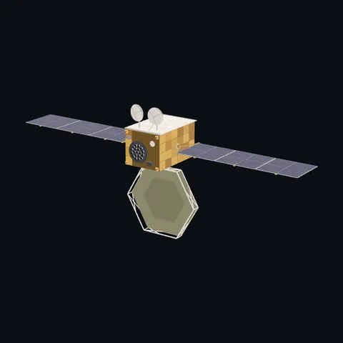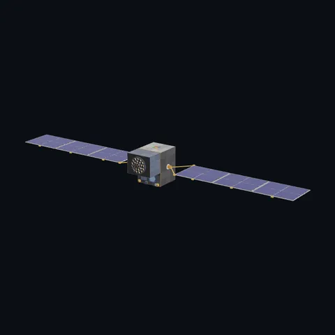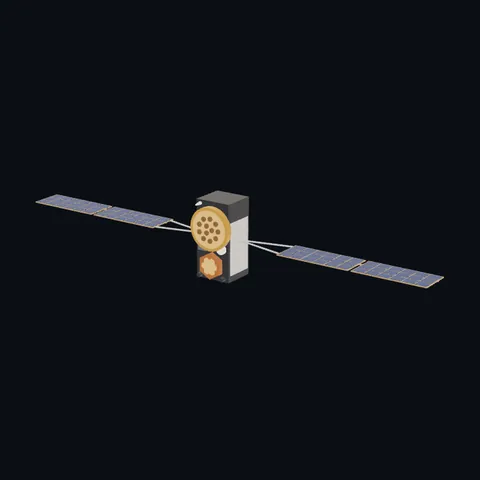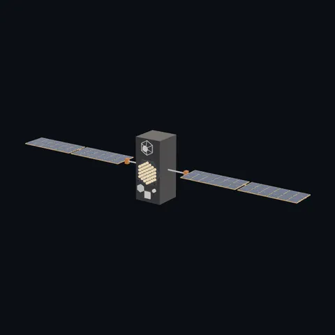
Michibiki
Shape built from published dimensions and pictures; details simplified.
Turn it in 3D
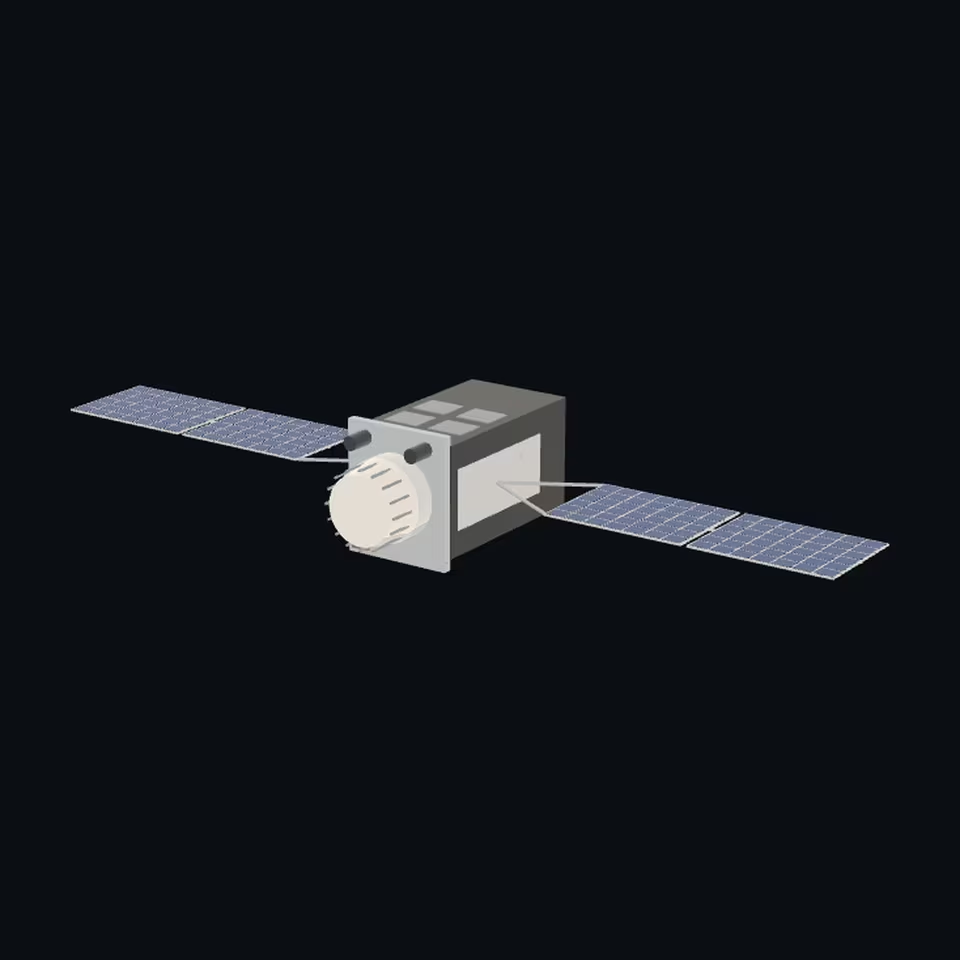
Open the 3D viewer (www.spaceradar.ai).
The viewer loads when you ask: about 700 kB the first time (three.js and the model), much less after.
Pictures 4
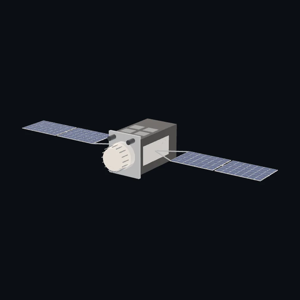 Three-quarter view
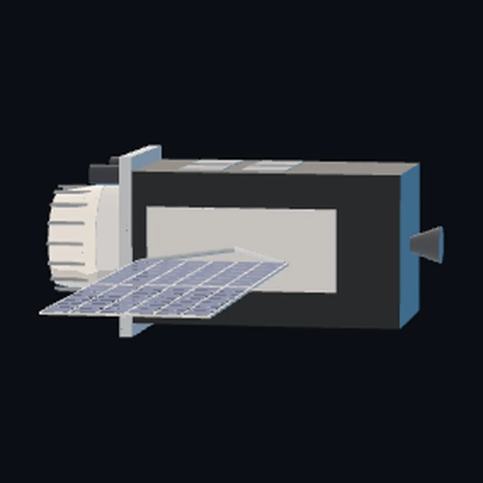 From the side
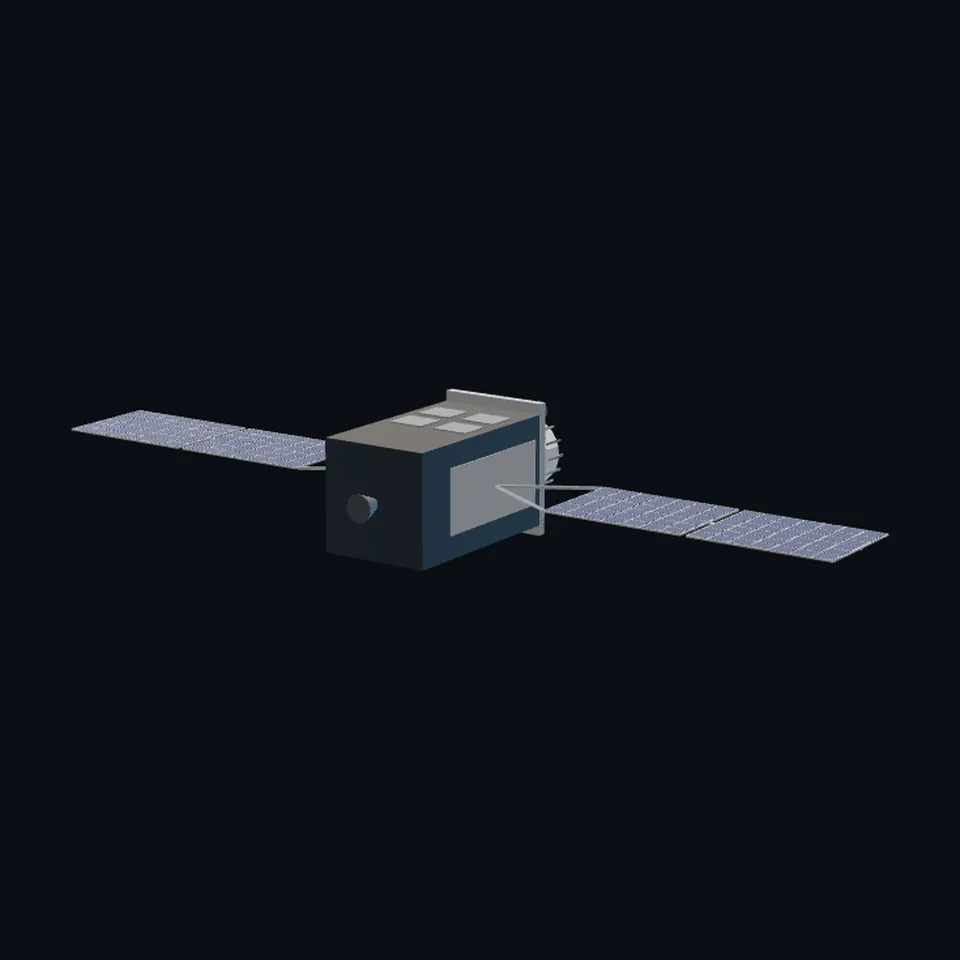 From behind
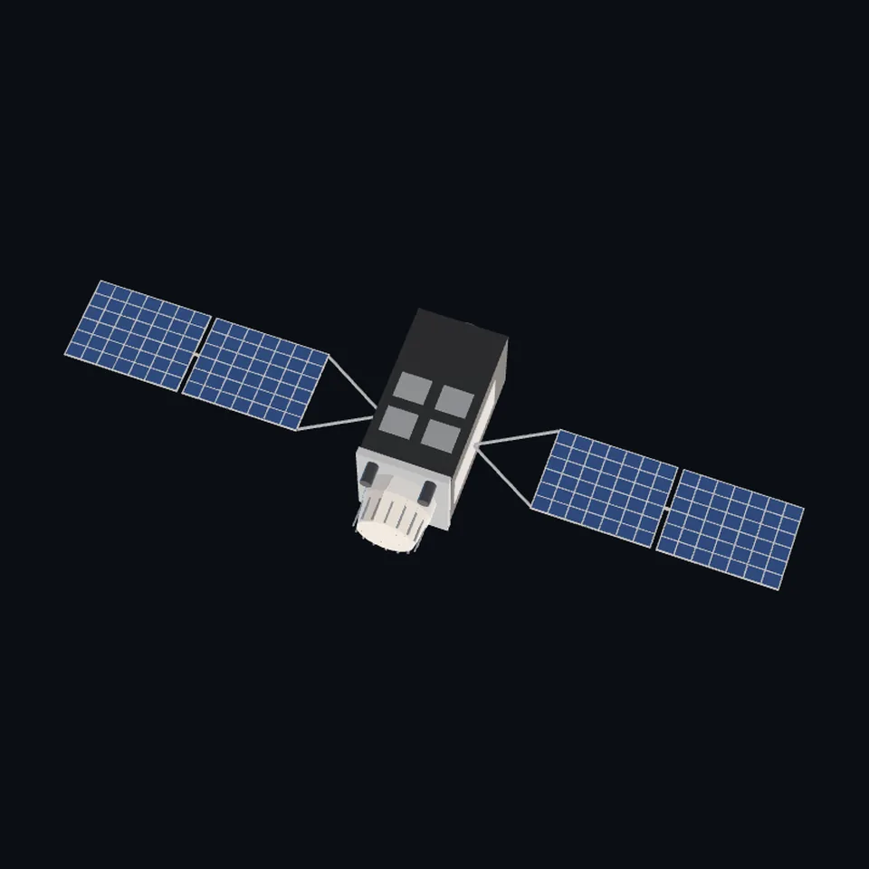 From above
About this model
Michibiki is one of the 203 3D models Space Radar made itself: a satellite, built in code from published dimensions and photographs, with no image-to-3D generator and no one else’s mesh.
Shape built from published dimensions and pictures; details simplified. It has 11,702 triangles in a 58 kB glTF file, and is 19 m across at full scale.
It is part of the map’s library; no object on the live map is drawn with it today.
Dimensions and their sources
| Measure | Value |
|---|---|
| Body 1 | 2.4 m |
| Body 2 | 2.4 m |
| Height | 6.2 m |
| Wing | 8.3 m |
| Span | 19 m |
| Solar array area | 14.9 m² |
| L ant cone bottom | 1.8 m |
| L ant cone top | 1.5 m |
| L ant cone height | 0.8 m |
Cabinet Office, Government of Japan, 'QZS-2 Satellite Information', SPI-QZS2_C (revision C, June 28, 2019), qzss.go.jp/en/technical/qzssinfo/khp0mf0000000wuf-att/spi-qzs2_c…, OPENED 2026-10-13 (the list it hangs from: qzss.go.jp/en/technical/qzssinfo/index.html), section 6 'Geometry', 'Figure 4 Satellite dimensions' '(Unit: mm)', whose dimension lines read 8300, 2400, 8300 (each wing, the body, the other wing: 19.0 m tip to tip), 6200 (height, nozzle to antenna top), 2400 and 2850 (the body and the antenna deck seen from the wing's side); Table 4 'Optical properties': 'SAP 14.9' m2 on each Y face, '+Y MLI 6.2, Radiator 3.9', '-Y MLI 5.7, Radiator 4.4', '+X MLI 10.1', '-Z MLI 5.6'; its note 1: 'L-ANT shape is approximately depicted as a truncated circular cone comprised of Ø1.5m and Ø1.8m circles 0.8m apart'; section 2: 'The +Z-axis is oriented to the bore sight direction of the L-ANT antenna. The +Y-axis is parallel to the rotation axis of the solar panels'; section 3 'Attitude Law': 'Yaw steering mode: The +z-axis is pointing to the Earth. The y-axis is oriented perpendicular to the plane made up by the Sun, Earth and satellite.' The same office's documents for the other craft (SPI-QZS1R_A, SPI-QZS3_F, SPI-QZS6, opened the same day) give the same 14.9 m2 arrays; the drawing of QZS-1R shows A FLAT ANTENNA DECK WITH NO CONE, and eoPortal, eoportal.org/satellite-missions/qzss, OPENED 2026-10-13, says: 'QZS-1, QZS-2, and QZS-4 have L-band antennas that are helical array antennas, but QZS-3 uses a flat patch antenna', so THIS FILE IS QZS-2 AND QZS-4 ONLY. JAXA, global.jaxa.jp/countdown/f18/overview/michibiki_e.html, OPENED 2026-10-13, of the FIRST Michibiki (retired): '2.9m in depth x 3.1m in width x 6.2m in height (Length between the tips of the paddles: 25.3 m)'. DERIVED: the body's box is 4.25 m long (a 10.1 m2 side face over 2.4 m); each wing is two panels of 3.2 x 2.33 m (14.9 m2) on a 1.9 m yoke. READ OFF THE DRAWING, which is not reproduced: where the wings stand on the body, the deck's two small helical antennas and the corner reflector, the nozzle. Colours are the render's: a black blanket, silver radiators, a white antenna cover. (read 2026-10-13)
How it was made
Built in code from published dimensions and photographs, with no image-to-3D generator and no one else’s mesh. 3D model: built by Space Radar from the dimensions in the Cabinet Office of Japan's QZS-2 satellite information; compared with a render from the Quasi-Zenith Satellite System website (CC BY 4.0).
The full record
built by this project in code (the private tool model-from-images: assemble.py, from a yaml of primitives), from the cited dimensions and the pictures under `references`; no image-to-3D model was used, and no published mesh (NASA's 3D Resources on GitHub, 1 583 paths read 2026-10-13, has none of this craft; the survey of 2026-10-13 found no agency model of it under usable terms)
Where the map uses it. any record of klass satellite named QZS-2 or QZS-4 (2 records in the live saved data of 2026-10-12: QZS-2 (MICHIBIKI-2), QZS-4 (MICHIBIKI-4)): the two Michibiki craft with the cone-covered helical antenna. They were, and while this file is on its way still are, the family navigation box at Galileo's size, a third of theirs. QZS-1R and QZS-6 wear qzs-1r.glb, QZS-3 qzs-3.glb and QZS-7 qzs-7.glb since release 1.8.0 (their antennas differ; internal #751); public #989
Licence note. The shape is this project's, under this repository's licence, built from published numbers (facts). The render compared with is CC BY 4.0 (Cabinet Office of Japan) and is not in the file. The Cabinet Office's dimension drawing was READ FOR ITS NUMBERS AND LAYOUT and is not reproduced. NO LOGO AND NO LETTERING is on the mesh.
References 1
What the shape was compared with. None of these pictures is in the file.
- QZS-1R CG05Quasi-Zenith Satellite System website, Cabinet Office of JapanCC BY 4.0 (Cabinet Office of Japan, Quasi-Zenith Satellite System website, qzss.go.jp/overview/download/cg-image1r.html)

Use it
The model is under the MIT licence: use it, change it and share it, in any project, also a paid one. Keep the credit:
Michibiki 3D model by Space Radar (spaceradar.ai), MIT LicenseAny glTF 2.0 loader that reads meshopt compression (EXT_meshopt_compression) opens the file: three.js with its MeshoptDecoder, Babylon.js, model-viewer. Tools such as glTF-Transform can write an uncompressed copy.
Or embed the viewer in your page:
<iframe src="https://www.spaceradar.ai/model/?id=michibiki" title="Michibiki, 3D model by Space Radar" width="600" height="450" loading="lazy" style="border:0;max-width:100%"></iframe>Related models